Since moving to Phoenix in September 2025, I have made it my mission to explore as much of Arizona’s great outdoors as possible. On this list, I will include all my favorite hiking trails within a day trip of Phoenix. If you’re up for a challenge, then you’re in the right place—my favorite hikes include scrambling and summiting high points/peaks.
This guide is continuously updated as I discover new trails, so be sure to check back later!
- Phoenix/Scottsdale Urban Hikes
- North & Northeast
- East (Superstitions & the Salt River)
- West (White Tank Mountains)
- Favorites Outside Phoenix
When to hike in Phoenix:
Locals know this, but for any visitors who might be planning a trip: DO NOT HIKE IN SUMMER. If you want to try an early morning walk at the Desert Botanical Garden or Papago Park, that is one thing (which I still would not recommend when the temperature regularly exceeds 100°F / 38°C from June-August). However, the hikes on my list are not a walk in the park. Beyond the risks of baking your body in the oven that is a Sonoran summer, leaving your car out in the sun at a trailhead might get you stranded in the desert.
Please determine your own limits by gradually increasing your heat exposure, and pack extra water.
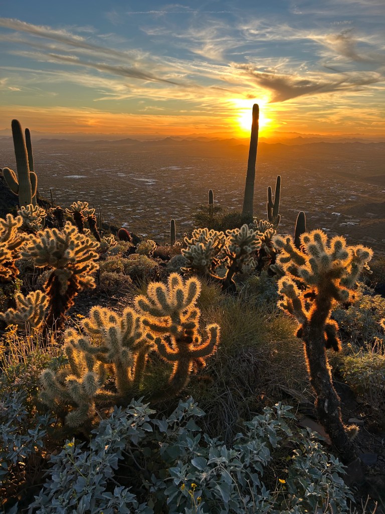
Morning and evening are the best times of day to hike. The desert is particularly vibrant from record rainfall in many of my pictures, but it still can be pretty colorless midday. The angled sun gives the desert an extra blast of color, especially given the incredible Sonoran sunrises/sunsets. During hotter months, hike in the morning to beat the heat. In winter, I like to switch to evening hikes. If you hike in the evening, check if the trail or its parking close after dark, and bring a headlamp.

Sedona is also within a day trip of Phoenix, so discover its best trails in my Sedona Hiking Guide.
Phoenix/Scottsdale Urban Hikes
These popular trails in Phoenix and Scottsdale are convenient for a quick hike, and I love watching the city lights come out at sunset. Although I prefer to seek out more secluded hikes, I’m grateful that these spaces exist within the city.
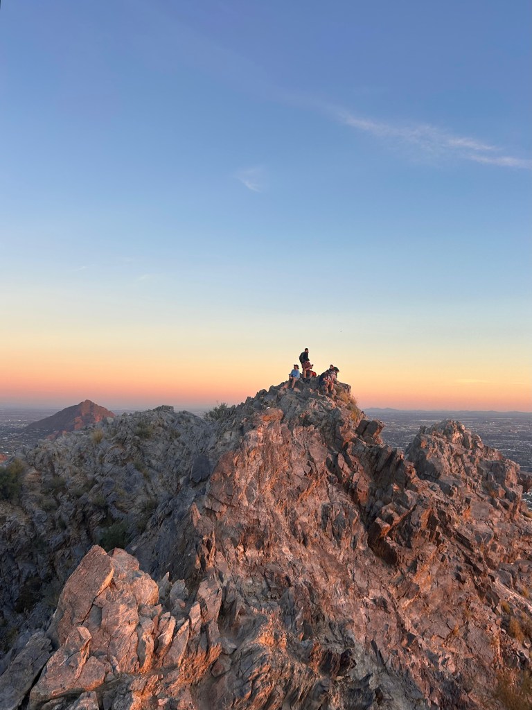
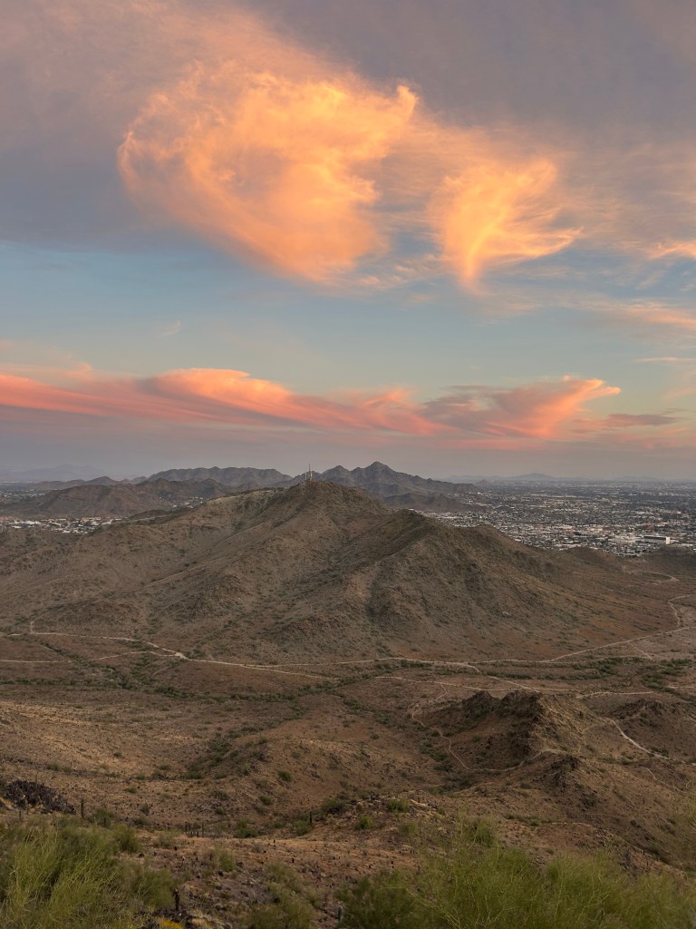
Camelback Mountain


Via Cholla Trail: 3 miles, 1300 ft elevation
Via Echo Canyon Trail: 2.5 miles, 1500 ft elevation
Camelback is the most iconic (and busiest) hike in the Phoenix/Scottsdale area. I usually avoid crowded trails, but I was completely alone on the peak during the rainy sunset pictured above. Echo Canyon, the more popular route, was closed that day.
Both trails have considerable scrambling toward the top, so don’t attempt this one if you’re afraid of heights. Echo Canyon is more challenging because it’s steeper.
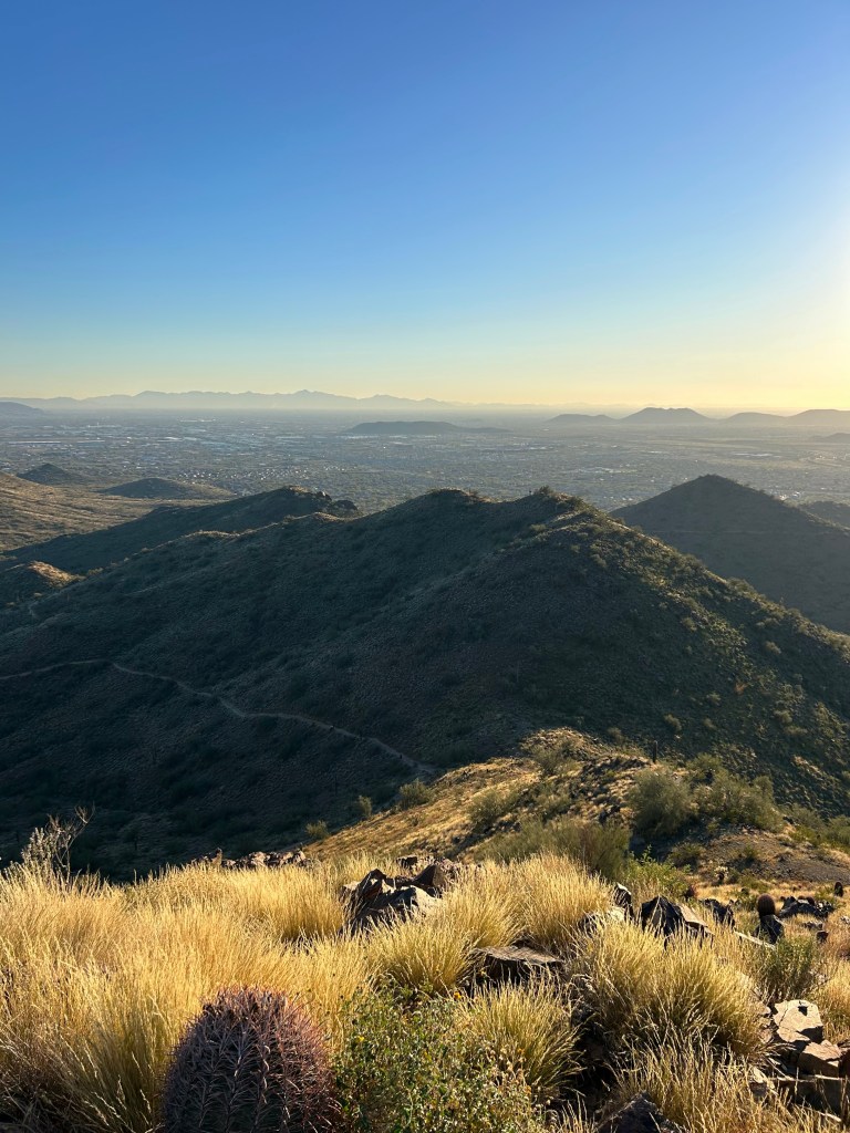
Piestewa Peak
2 miles, 1100 ft elevation
Don’t underestimate how long a mile can feel with steep elevation. Inside Phoenix Mountain Preserve, this trail feels slightly more remote than Camelback while being close to the city center. It’s too crowded to earn a spot on my rotation, but this is many locals’ go-to hike, especially at sunset.
Freedom Loop

4 miles, 1000 ft elevation
This trail is a loop around Piestewa Peak, and it’s a nice alternative because the backside of the loop isn’t crowded, even on a Saturday evening when I did it. It’s a great escape from the city without actually leaving the city.
North Mountain


1 mile, 700 ft elevation
This is a quick hike with a big reward. There are multiple routes up North Mountain; the most popular is the one on AllTrails, which is a combination of uneven terrain and pavement. There’s a paved service road up to the cell tower for those who prefer even ground.
Shaw Butte
3 miles, 800 ft elevation
Shaw Butte is North Mountain’s quieter neighbor. My distance tracked is out-and-back from Shaw Butte Trailhead, but there are numerous possible routes. Much of the trail is an unpaved service road.
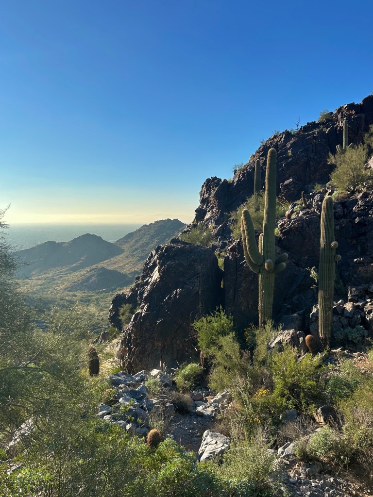
North & Northeast
If my commute wasn’t a factor, I would want to live northeast of Phoenix: Cave Creek, Carefree, Fountain Hills, or North Scottsdale. McDowell Sonoran Preserve is my favorite park/preserve in the Greater Phoenix Area, and I love the views of the Four Peaks. I think the landscape is greener and has more variation in trails.
Tom’s Thumb

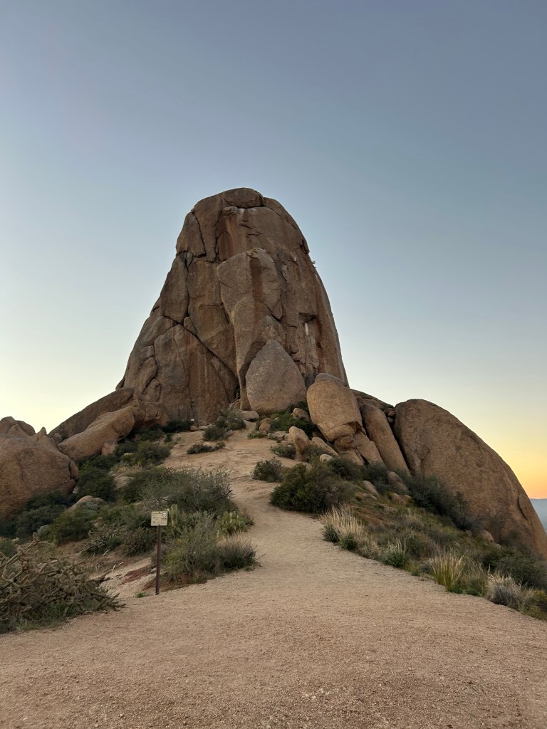
4 miles, 1200 ft elevation
This trail was my first recommendation to my parents when they visited. It’s well-maintained and beautiful. The boulder landscape atop the ridge is unique to this area and glows red at sunset.
Pinnacle Peak
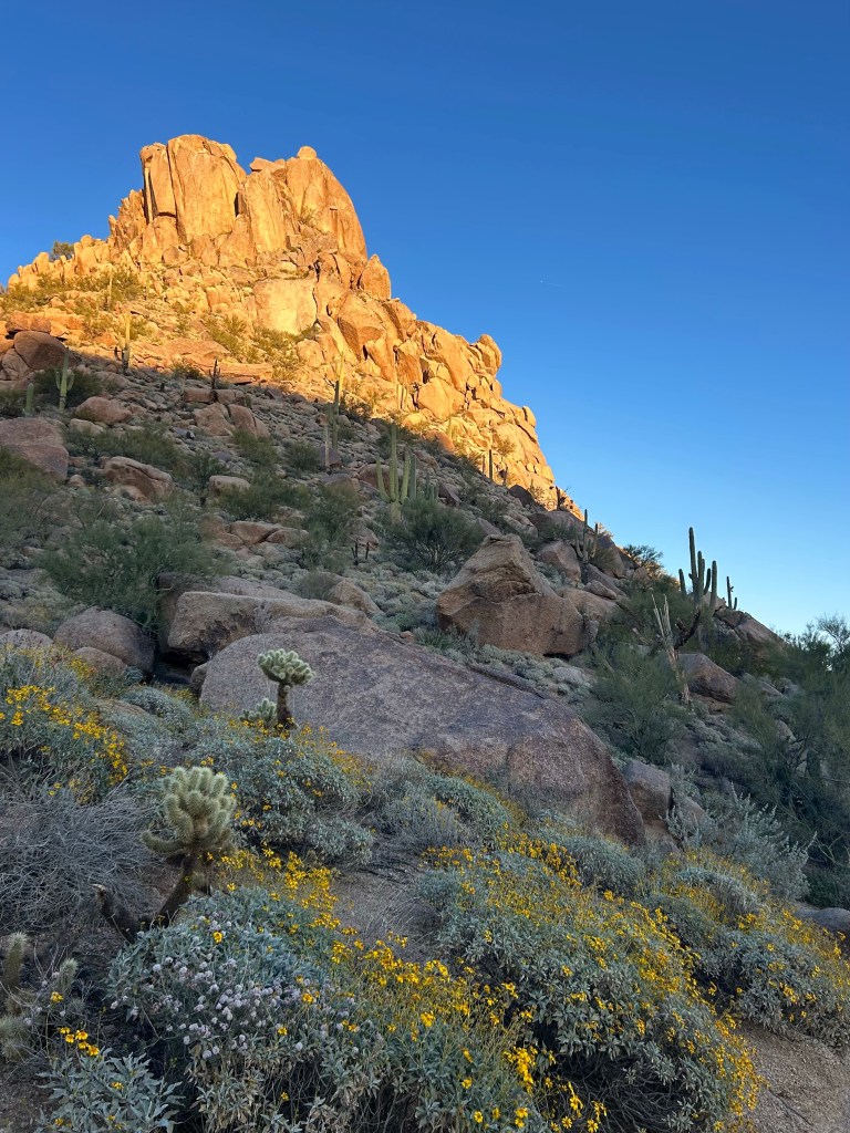
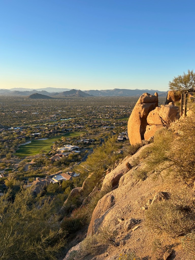
4 miles, 1000 ft elevation
Pinnacle Peak Trail is maintained as pristinely as the North Scottsdale golf courses it overlooks. It doesn’t have a rugged or remote feel, but it’s still a lovely slice of nature, especially with the golden evening sun hitting the rocks. The high point is in the middle of the trail, so you may want to turn back before descending the switchbacks for a 3-mile roundtrip.
Dixie Mountain Loop
5.5 miles, 900 ft elevation
This trail is an underrated gem in Sonoran Preserve—it was quiet even on a perfect Saturday evening. My distance tracked includes Dixie Peak, which is a short spur off the loop trail. It’s on the northern outskirts of Phoenix, so it’s convenient for a quick escape from the city.
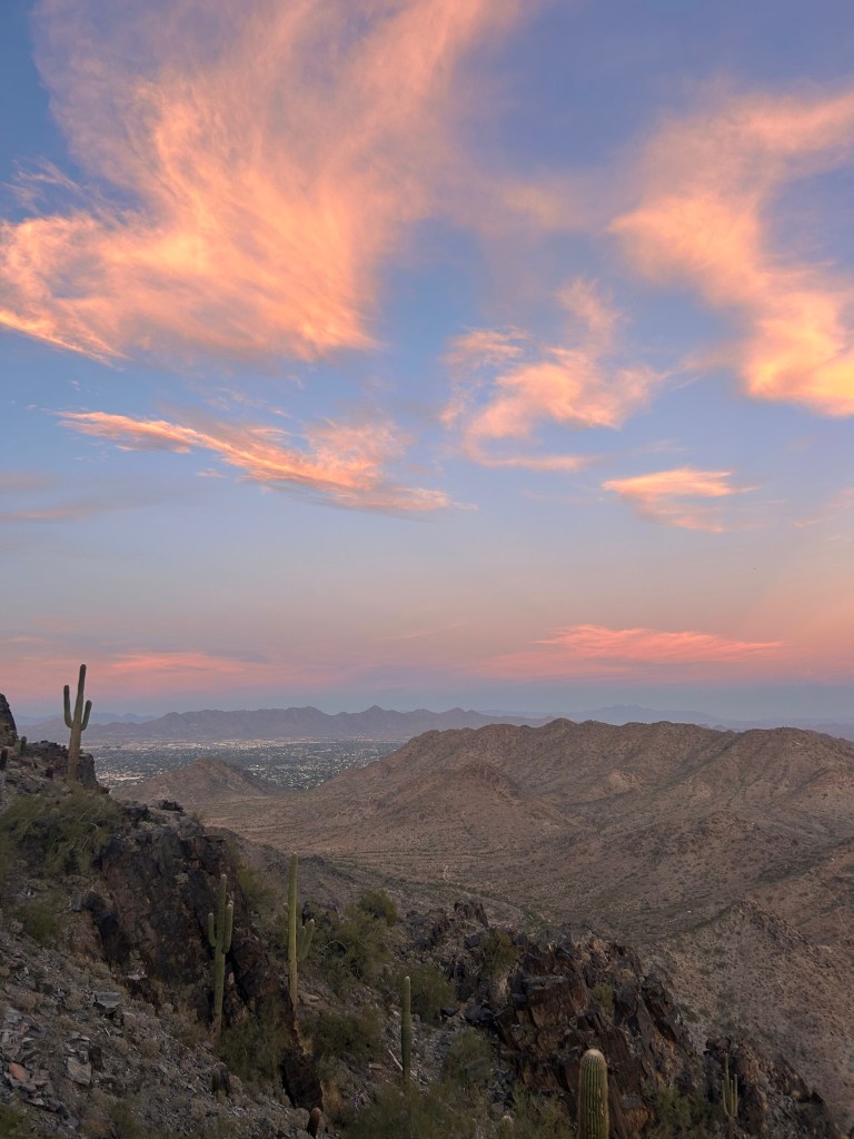
Black Mountain
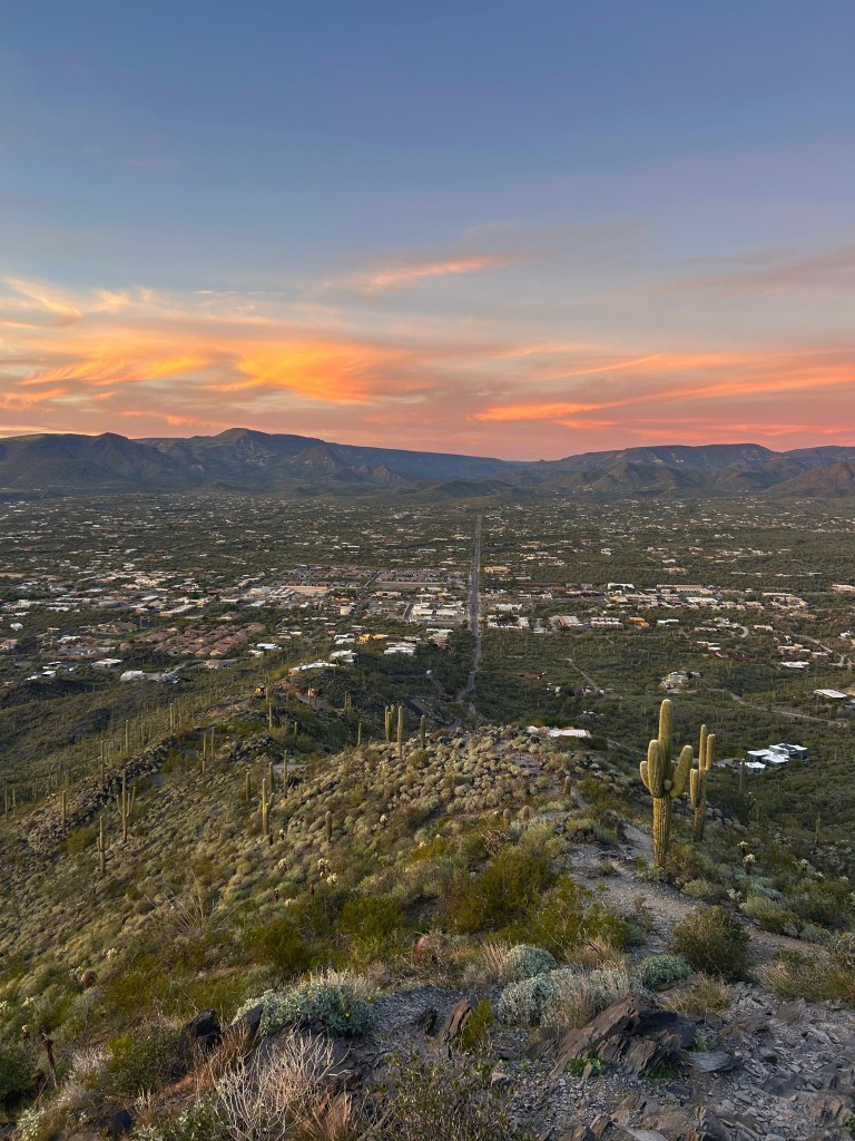
2.5 miles, 1200 ft elevation
Black Mountain is like Camelback’s more scenic sister; they’re similar in difficulty, though Black Mountain has slightly less scrambling. This trail was uncrowded and beautiful (even without the stunning sunset pictured). Black Mountain is between Cave Creek and Carefree, and I could hear Buffalo Chip Saloon from halfway up the mountain.
The trailhead is in a residential area, so my distance tracked includes an extra quarter-mile to where I parked. Turn left on Military Rd as you approach the trailhead, and there’s a gravel shoulder where you may park.
Thompson Peak


10 miles, 2000 ft elevation
I started at the Dixie Mine trailhead, which requires a walk through a gated neighborhood to access (included in my distance tracked). Dixie Mine Trail connects to the Thompson Peak service road, which is unpaved until the last mile where it gets dangerously steep. I was the only person on the trail on a beautiful Saturday evening, so it seems this is a hidden gem—or perhaps too strenuous for the average hiker.
Palo Verde
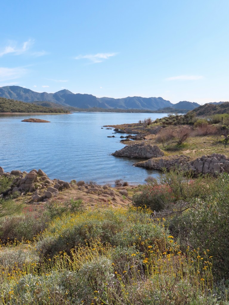
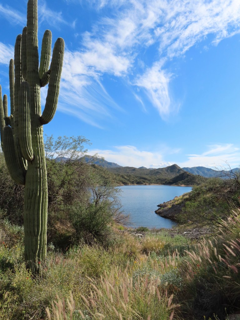
8.5 miles, 800 ft elevation
Palo Verde Trail follows the shoreline of Bartlett Lake (a.k.a. Bartlett Reservoir). There were a few people fishing along the first half mile of the trail at Rattlesnake Cove, but I had the rest of the trail to myself on a Saturday afternoon. I explored little beaches and encountered many hummingbirds on this early spring day.
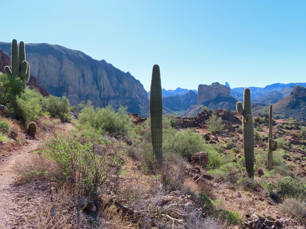
East (Superstitions & the Salt River)
When I want to go deep into the wilderness, I head east. The beautiful Superstition Mountains, including Lost Dutchman State Park, are just past Mesa. This mountain range is rugged with dramatic cliffs, making it especially appealing to adventurous hikers like me. The Salt River meanders alongside the Superstitions, nourishing the desert and carving stunning river bluffs.
Flatiron


5.5 miles, 2600 ft elevation
Flatiron is my idea of a good time—lots of scrambling. This peak is iconic with locals, so the trail stays moderately busy despite being difficult. For the most part, the scrambling is comparable to Camelback with less exposure, but there’s a small section at the top nicknamed “the wall” that’s slightly more technical.
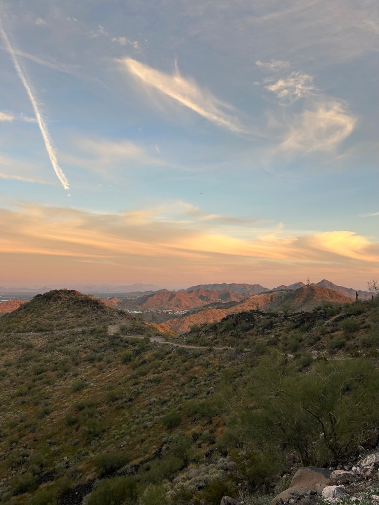
Boulder Canyon & Lower La Barge Box
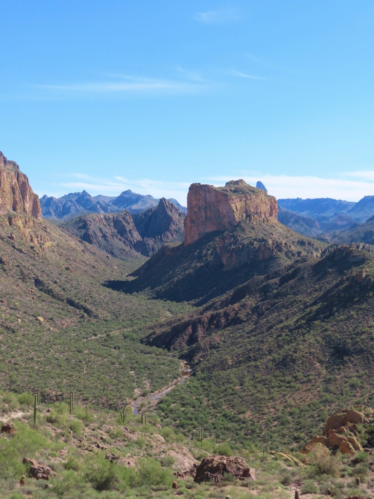
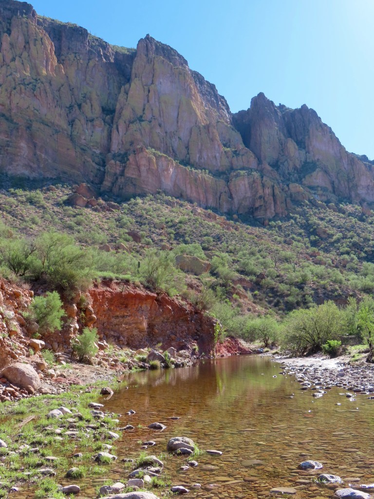
10 miles, 2000 elevation ft gain
This trail was an unexpected favorite! I hiked it after heavy rain, so the lower canyon water level was up to my waist in some spots. (Note: the river is the Lower La Barge Box trail.) I hiked it as a loop around Battleship Mountain, going counter-clockwise to save the river wading for last. The trail not well-marked around the backside of Battleship, so I recommend downloading a satellite map.
As a less intense option, there’s a beautiful viewpoint on Boulder Canyon Trail around mile 2.5 (5 miles roundtrip) pictured above, just before the descent into the canyon.
Wave Cave

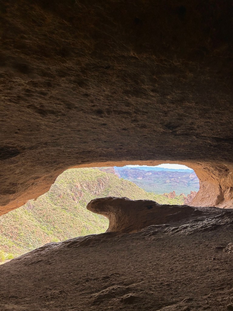
3 miles, 800 ft elevation
What a little gem of a trail! I sat in the back of the cave with a snack, and, after about ten minutes, there was a small window during which I had the cave all to myself on a Saturday. (PLEASE do not sit in the middle of the view, people!) I combined this hike with Carney Springs Waterfall, as they share a trailhead. The trailhead is down a dirt road, but it’s well-maintained and my low-clearance Toyota Camry made the drive just fine!
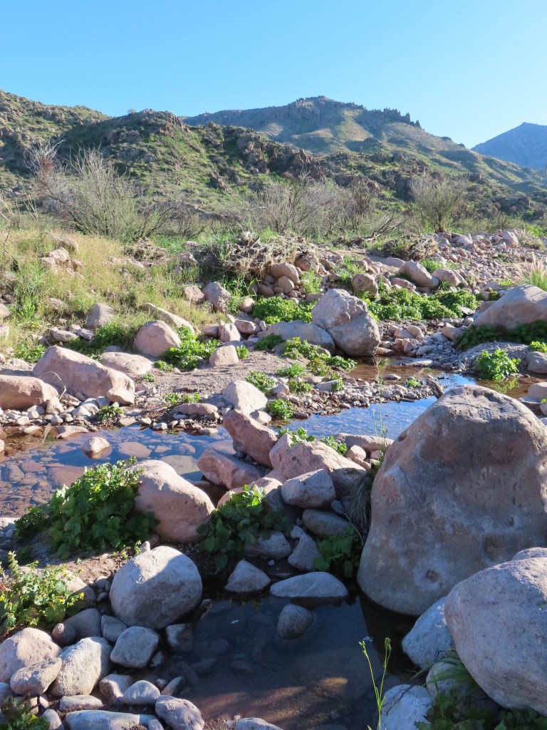
Carney Springs Waterfall
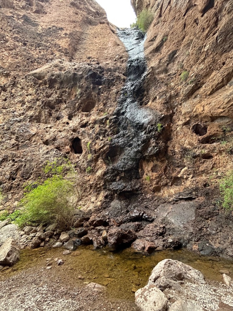

3 miles, 500 ft elevation
The falls can be combined with Wave Cave for around 5 miles roundtrip, as they both branch off the Carney Springs trail. I hiked after rain, so there was a small flow. It was difficult to capture the crevice where the falls is, but it’s such a wonderful spot.
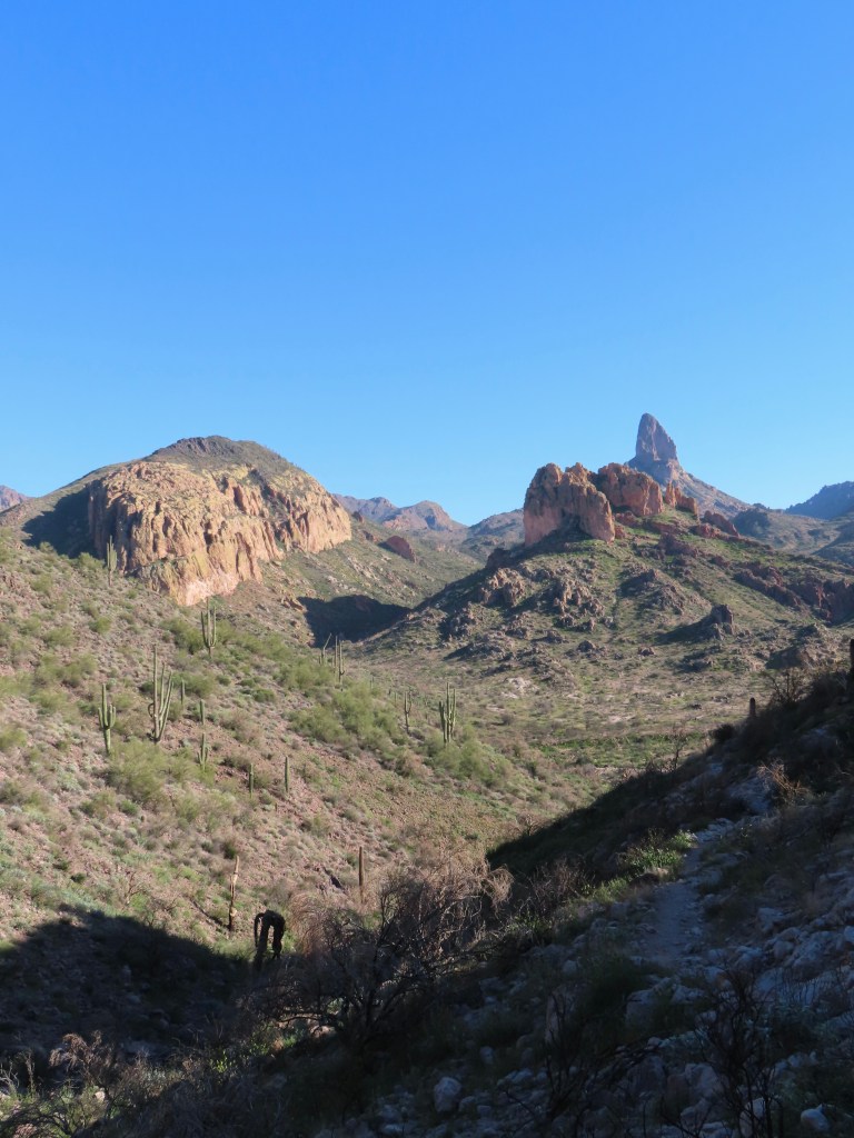
Peralta Canyon to Weaver’s Needle Overlook


5 miles, 1300 ft elevation
The view of Weaver’s Needle from Fremont Saddle is fantastic! It’s not visible until you reach the top, so it’s quite the grand reveal. However, there are still plenty of great views overlooking Peralta Canyon on the way up. I did this hike on a rainy day (yes, we get those sometimes), and I definitely plan to go back at sunrise to see the morning light on Weaver’s Needle. This trailhead is further down the dirt road mentioned in Wave Cave/Carney Springs.
Broadway Cave
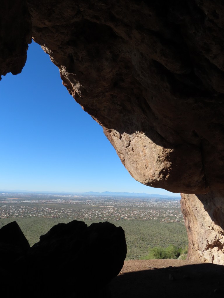
4 miles, 800 ft elevation
Broadway Cave is the trail’s main attraction, but the morning light on the Superstitions was my favorite part. The trail was crowded on a Saturday morning, but I caught a lull between the sunrise and late morning hikers and had the cave all to myself. The Broadway Trailhead parking lot is small, and there were a dozen cars with parking tickets on my return. Pay attention to the parking signs, and don’t park along the curved part of the road immediately surrounding the trailhead parking.
Black Mesa Loop
9 miles, 1000 ft elevation
This is a classic Superstition hike with the highlight being its views of Weaver’s Needle. It’s similar to Boulder Canyon & Lower La Barge Box but with half the elevation gain. There are great views in every direction, but I think hiking counterclockwise is slightly prettier. Black Mesa Loop connects Dutchman and Second Water trails; one of the junctions is not well-marked, so a satellite map is useful. The trailhead is at the end of dirt road that’s navigable in most passenger vehicles.
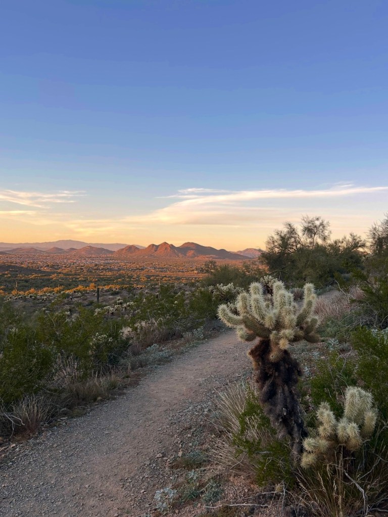
Pass Mountain
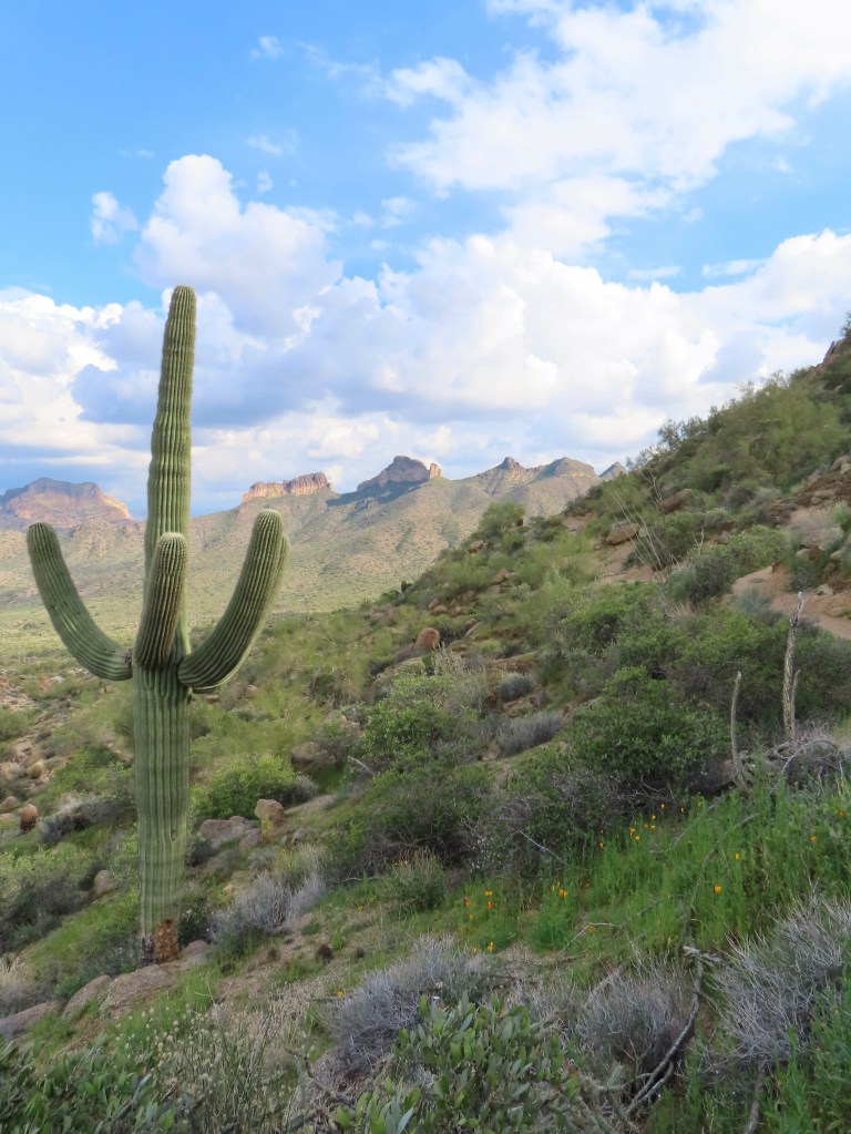
8 miles, 1000 ft elevation
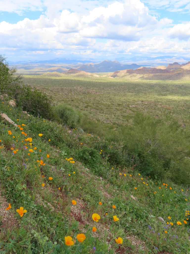
This trail is in Usery Mountain Park, just outside the Superstition Mountains. It’s a loop trail around Pass Mountain, and I recommend hiking it clockwise for the best views. It’s a classic desert hike with plentiful saguaro, orange rock, and gorgeous valley views. Spring is arriving early to the Sonoran, and there were wildflowers on my hike in late January! The trail is not too rocky, making it popular with trail runners.
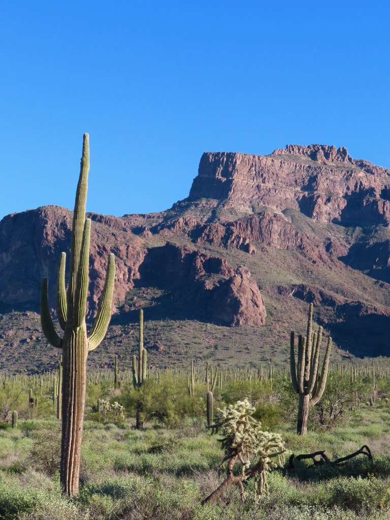
Picketpost Mountain


4.5 miles, 2000 elevation
There is a lot of scrambling and loose rock on the trail, so proceed with caution. Even following my AllTrails satellite map, it was easy to lose the trail and find myself in a sketchy spot on the cliff bands. However, it was well-worth the challenge; I loved going through the letters and assorted items in the mailbox at the top. (Picketpost is technically a freestanding mountain not considered part of the Superstitions.)
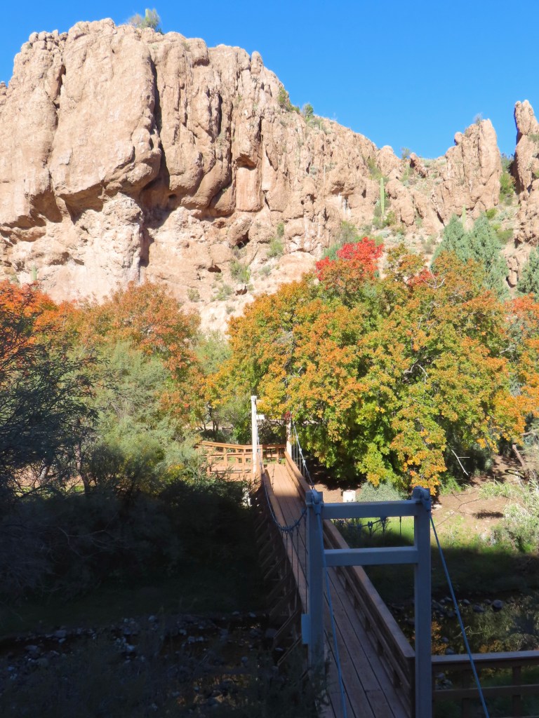
Picketpost Mountain is right by Boyce Thompson Arboretum, which I recommend visiting while you’re in the area! The fall colors usually peak at the end of November/ beginning of December.
Butcher Jones

6 miles, 600 ft elevation
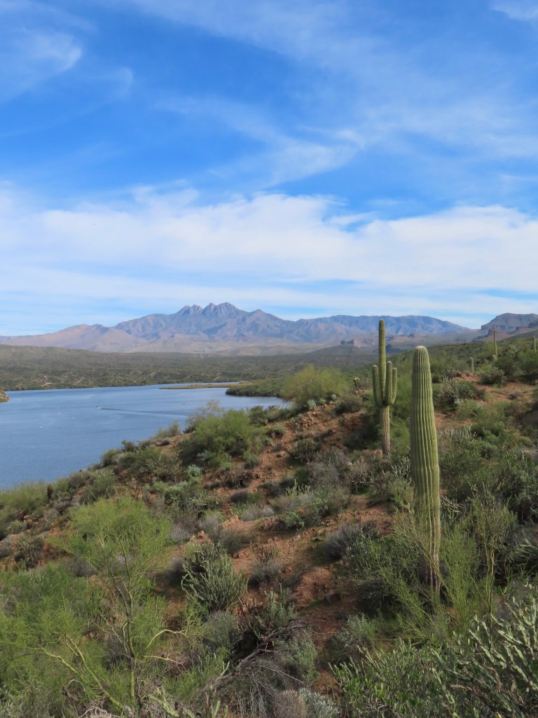
This trail meanders along Saguaro Lake on the Salt River with gorgeous views of the Four Peaks. The trail splits off to two equally lovely end points: Butcher Jones viewpoint and a trail down to the shoreline. My distance tracked includes both!
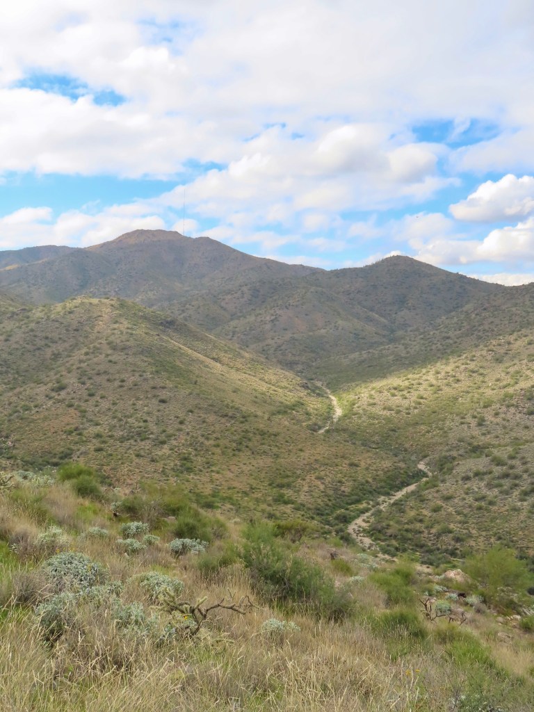
Vineyard Trail

7 miles, 1800 ft elevation
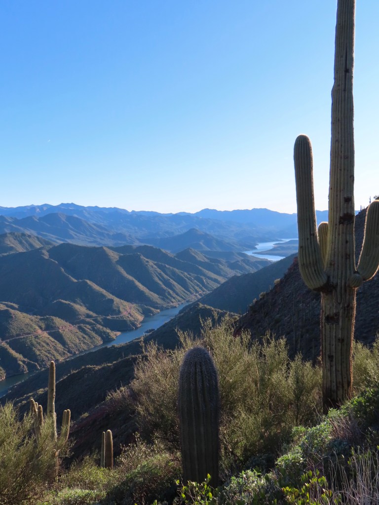
This trailhead is a two-hour drive from central Phoenix, beginning at Theodore Roosevelt Lake and heading into the Four Peaks area. The beginning of the trail overlooks Theodore Roosevelt Lake, including the iconic bridge and dam, ascending Vineyard Peak to overlook the Salt River Valley (pictured above at mile 2). You could turn back here for a 4-mile roundtrip, but my suggested distance is mile 3.5 (7 miles roundtrip) for more incredible Salt River Valley and Four Peaks views.
There was a harsh glare on the river at midday that disappeared by my return in the evening, so I definitely recommend an evening hike!
West (White Tank Mountains)
The White Tanks are West of Phoenix, and the best hiking trails are in White Tank Regional Park, which charges $10 per vehicle for entry. These mountains are less severe than the Superstitions, so the hiking is similarly less scramble-y/intense. The trails are well-maintained through winding mountain valleys.
Mesquite Canyon and Willow Canyon Loop

8.5 miles, 1500 ft elevation
This is a loop that combines Mesquite Canyon and Willow Canyon trails. I also highly recommend taking a half-mile detour down the Goat Camp trail, as it ascends out of the canyons to a ridge with fantastic views. This was my first White Tanks hike, and it surpassed my expectations!
Favorites Outside Phoenix
While it’s possible to visit these areas as a long day trip from Phoenix, calling them “Phoenix hikes” would be a stretch. But my list felt incomplete without them!
Humphreys Peak, Flagstaff


10 miles, 3300 ft elevation
This is a tall order for a day hike from Phoenix, being Arizona’s highest peak! If you can handle the elevation, it’s a well-maintained trail to the top. Despite being in Arizona, it’s cold and windy above 10,000 ft.
Bear Canyon to Seven Falls, Tucson

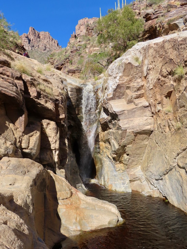
8.5 miles, 1000 ft elevation
After an unusually rainy fall and some early winter snowmelt, there was plenty of water in Bear Canyon when I hiked it. I counted seven water crossings before reaching the main falls at the trail’s end. However, I did see reviews on AllTrails from seasons when the falls were completely dry, so beware!

I will add more favorites to this list as I discover them; follow me on TikTok for updates!

Leave a comment